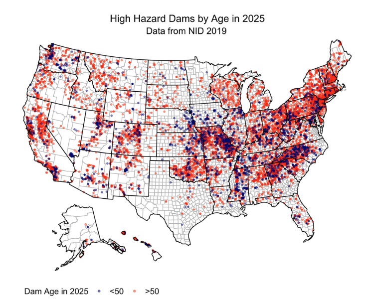
ABOVE: Deanna Hence. TOP: High hazard dams in the United States by age projected to 2025. Credit: Paulina Concha Larrauri, Upmanu Lall, and Mohammad Amin Hariri-Ardebili
It’s no secret that big environmental problems tend to require interdisciplinary solutions. In the case of monitoring the risks that aging dam infrastructure imposes, storm watchers, engineers, and sociologists all have a part to play.
Deanna Hence, Assistant Professor of Atmospheric Sciences at the University of Illinois, aids in the intercollegiate Institute for Geospatial Understanding through an Integrative Discovery Environment (I-GUIDE) efforts to put a spotlight on the effects of fragile dams on nearby populations.
With global climate change resulting in unpredictable and extreme patterns of rainfall, dams in the United States are in a vulnerable state. Heavily aged dams are at an even greater risk of succumbing to the effects of extreme weather. As such, dam failure has become a prevalent issue, endangering communities located underneath the infrastructure.
“As I-GUIDE was coming together, it was identified pretty quickly that when we’re thinking about problems of sustainability, our infrastructure and how resilient it is to climate change is a very, very chief concern for sustainability issues going into the future,” Hence said.
Researchers within the convergence science team at I-GUIDE analyze data related to the vulnerability of water infrastructure due to climate change. They look for characteristics about their status, how well they have been maintained, and any geographical features that make them particularly vulnerable to climate extremes.
Dams protect and provide for communities. They are built to help prevent flooding, supply drinking water, and control water flow. I-GUIDE researchers access a database sourcing dams from all over the country and overlay it with global weather and climate data through statistics and other advanced computation tools.
“This (project) is not only looking at how these weather and climate patterns are spread across the country and how frequently they occur, but also how these patterns are changing with time,” Hence said. “It covers both the spatial component and also the temporal component.”
Some of the most critical findings on this project come from statistics experts Adam Tonks, Bo Li, Jeongwoo Hwang, and Upmani Lall from the University of Illinois, Carolina State University, and Columbia University. They discovered the variation in risk of dam failure associated with one-day, 30-day, and compound precipitation events. Thirty-day events are defined by moderate periods of rainfall (with “moderate” defined as a rainfall event that alone would not cause dam failure), whereas one-day events are a single extreme period of rainfall. Researchers found that the combination of the two is what led to the most dam failures, aligning with previously established theories that climate change intensifies the frequency of extreme weather events.
Using these computational models, I-GUIDE members highlight different regions of the country where there is a high concentration of vulnerable dams in hopes that the information can be used by decision-makers. Some subsequent intervention mechanisms include repairing, replacing, or removing dams.
Additionally, I-GUIDE focuses heavily on the socioeconomic dimension of the aging stormwater infrastructure data. Social scientists Courtney Flint, Bailey Holdaway, Kwaku Opoku-Ware, and Jinwoo Park from Utah State University and the University of Illinois found that communities located in more socioeconomically disadvantaged areas have greater risks associated with aging dam infrastructure. However, this pattern is highly region-specific, and some parts of the country are more mixed in terms of socioeconomic development and dam risk. Some areas considered hotspots of risk for socioeconomically disadvantaged communities include parts of California, Colorado, New Mexico, New Hampshire, and Massachusetts.
“It does vary across the country,” Hence said. “It’s one of those things where saying an overarching result for the entire country is a bit difficult. But hopefully, that information can help inform decision-makers, especially for the regions most at risk.”
A large quantity of data collection is required for such an interdisciplinary project. A concept pioneered by I-GUIDE researchers at Illinois called the geospatial knowledge hypercube was designed to provide a structure for integrating geospatial data together. The hypercube helps reduce the manual labor involved with tagging individual pieces of data and package information in ways that are more easily accessible for analysis. More efforts are needed to provide tools to researchers that can engage in high-performance computing, such as building connectors to be able to use Jupyter Notebook in accessible locations.
Hence and her team’s work specifically focuses on the atmospheric behavior associated with the patterns identified by statistical analyses. Weather and climate models are used to identify “warning signs” of precipitation that are likely to break a dam. University of Illinois Atmospheric Sciences Ph.D. student Hodo Orok leads efforts to identify weather systems behind these critical precipitation events.
With the effects of climate change increasingly rampant, it is more important than ever for scientists of all disciplines to work together. Hence advocates for multiple viewpoints when it comes to issues regarding sustainability and infrastructure. “I think one of the biggest things about this project is that it shows both the importance and the power of bringing many, many disciplines together to look at a particular problem. It means that we can get so much further in really understanding the nature of the problem.”
To learn more about the Vulnerability Analysis of Aging Dam Infrastructure project, check out its page on the I-GUIDE website >>>
— Article by iSEE Communications Intern Anjali Yedavalli

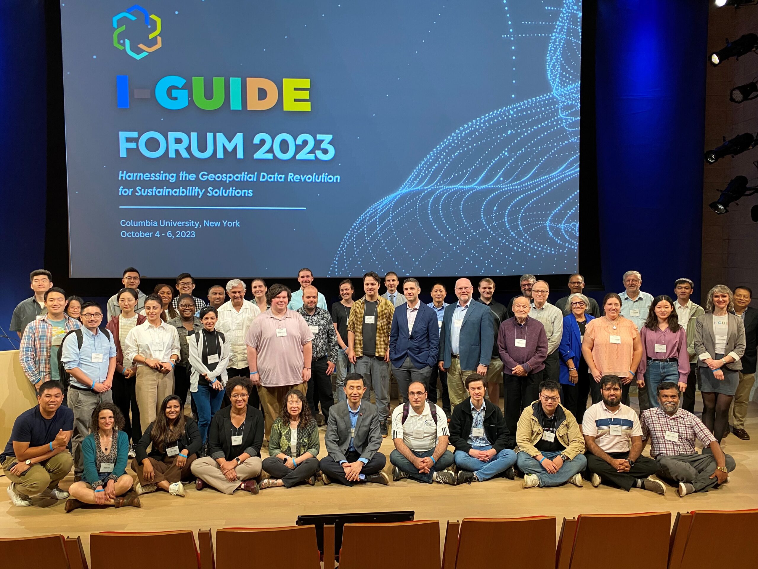
The I-GUIDE team at the I-GUIDE Forum 2023 conference. Credit: Brian Enright/Columbia University
